


El historiador José Beneroso propone tras un pormenorizado estudio el río Guadarranque y no el Guadalete como el verdadero escenario de la batalla que inició la invasión árabe de la Península Ibérica
¿Sería posible que el enfrentamiento entre las huestes de Tarik con los visigodos de Don Rodrigo se hubiera producido realmente en el Campo de Gibraltar?
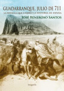
Así lo afirma el profesor de Historia José Beneroso en su último libro, “Guadarranque, julio de 711”, fruto del trabajo de su tesis doctoral, en el que defiende que la batalla decisiva para invasión musulmana de la Península Ibérica se desarrolló junto al río Guadarranque, y no junto al Guadalete, como se afirma tradicionalmente”.
 Basándose en su conocimiento del terreno, el análisis detallado de la toponimia local y de las primeras fuentes históricas, y la logística militar de la época, el historiador linense difiere de la ortodoxia histórica desde el mismo momento del desembarco de Tarik y sus tropas. Su percepción de que Gibraltar no era un lugar adecuado para un gran número de soldados le lleva a ubicarlo en la zona de Guadalquitón, que significa «Valle de la Acampada».
“Estos hechos han sido estudiados por historiadores de gran renombre como Sánchez Albornoz, pero que no conocían el terreno”, explica el autor. “En mi opinión el error fundamental ha sido no identificar correctamente los topónimos que aparecen en las primeras fuentes históricas árabes, lo que pudo provocar que, desde el siglo pasado, se haya ubicado erróneamente la invasión y la batalla”.
“Mi trabajo se basa en tres topónimos fundamentales: la montaña Traductina, que por su morfología correspondería al Peñón de Gibraltar; el río Wādīlakko, que yo lo identifico con el Guadarranque; y el término al-Buḥayra, que para mí se refiere a la Bahía de Algeciras”, continúa Beneroso. “En la antigüedad no existía la definición actual de ‘Bahía’ como tal y al-Buḥayra se utilizaba para identificar cualquier zona de agua rodeada de tierra, pudiendo aplicarse a un lago, una albufera, pero también a una bahía”.
En cuanto a la batalla, el historiador la ubica junto al Guadarranque, identificando El Chapatal, entre Castellar y la Estación de San Roque, como el lugar más propicio para un enfrentamiento de ese tipo. “Aquellas tropas bereberes, al contrario que las visigodas, no contaban con caballería. Si desembarcaron en el Campo de Gibraltar no tendría ningún sentido trasladarse a pie decenas de kilómetros en pleno mes de julio hasta el Guadalete para enfrentarse al enemigo. Lo más lógico habría sido esperarle en un escenario más favorecedor y no darle esa ventaja a la caballería pesada visigoda”.
Además, el descubrimiento en la zona de una moneda bereber, similar a las que se entregaban como pago a las tropas, contribuye a respaldar la teoría del historiador linense a falta de más hallazgos arqueológicos hasta el momento.
___________________________________________________________________
«Guadarranque, July 711», a revision of a pivotal moment in Spanish History
After a detailed investigation, historian José Beneroso proposes that the Guadarranque river, and not the Guadalete, was the true scene of the battle that marked the beginning of the Arab invasion of the Iberian Peninsula.
Is it possible that the confrontation between Tarik’s army and Don Rodrigo’s Visigoths had actually taken place in the Campo de Gibraltar?
This is what history professor José Beneroso states in his latest book, «Guadarranque, July 711», the result of his doctoral thesis, in which he argues that the decisive battle for the Muslim invasion of the Iberian Peninsula took place along the Guadarranque river, and not along the Guadalete, as is traditionally claimed.
Based on his knowledge of the terrain, detailed analysis of local toponymy, early historical sources, and the military logistics of the time, this historian from Linares differs from the historical orthodoxy at the very moment of the arrival of Tarik and his troops. His realisation that Gibraltar was not a suitable place for a large number of soldiers to be in led him to locate the site at Guadalquitón, the meaning of which is «Valle de la Acampada» (Valley of the Encampment).
«These historical events have been studied by renowned historians such as Sánchez Albornoz, though they did not have a knowledge of the terrain,» the author explains. «In my opinion, the fundamental error was not correctly identifying the place names that appear in the first Arab historical sources, which may have meant that, as of the last century, the invasion and the battle were erroneously situated».
«My work is based on three fundamental toponyms: the Traductina mountain, whose morphology would correspond to the Gibraltar Rock; the Wādīlakko river, which I equate to the Guadarranque; and the term al-Buḥayra, which I believe refers to the Bay of Algeciras,» Beneroso continues. «‘Bay’ as such did not exist in ancient times, and al-Buḥayra was used to identify any area of water surrounded by land, and could be applied to a lake, a lagoon, or even a bay».
As for the battle, the historian locates it next to the Guadarranque, identifying El Chapatal, between Castellar and the San Roque station, as the most conducive place for such a confrontation. «Those Berber troops, unlike the Visigoths, did not command cavalry. If they landed in the Campo de Gibraltar, it would have made no sense to travel dozens of kilometres on foot during the month of July to the Guadalete river in order to confront the enemy. The most logical thing to do would have been to wait for them in a more advantageous setting and not give the Visigothic heavy cavalry that advantage».
Furthermore, a Berber coin found in the area, similar to those that were given as payment to the troops, helps to support the Linares historian’s theory in the absence of further archaeological findings to date.


